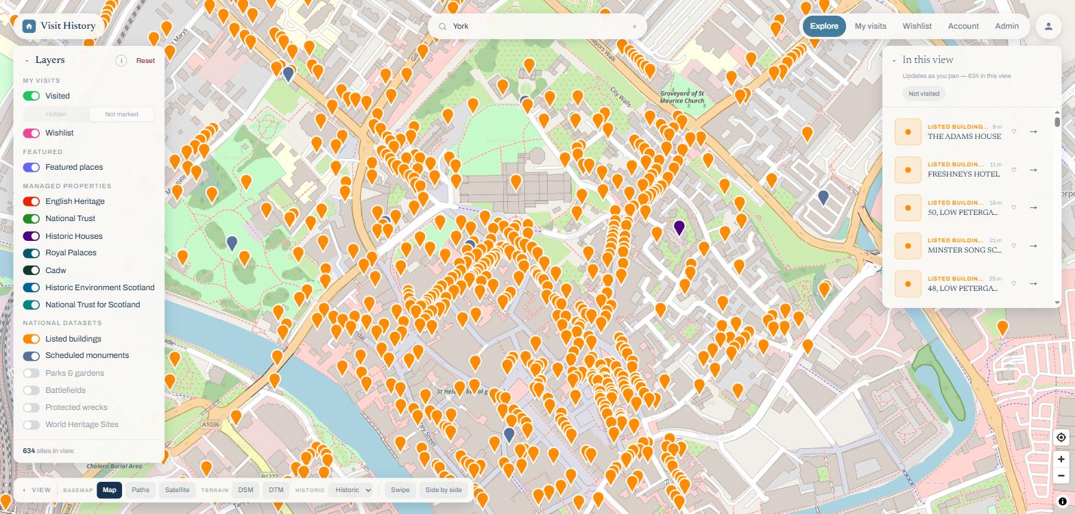
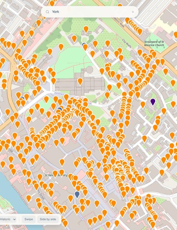
Every historic site in the UK. On your phone, and now in your browser.
Discover history everywhere. Remember every visit. One account keeps your visits, wishlist and photos in step between the app and the web.
7-day free trial · no payment details needed
One account, everywhere
Log a visit at the castle gate on your phone. It is already on the big map when you get home. Same sign-in, same subscription, nothing to set up twice.
What you’ll find
One map of the UK’s heritage, built from the official registers and the organisations that manage the sites.
435,000+
NHLE & Cadw listed sites
Listed buildings, scheduled monuments, battlefields, wrecks and more, from the official registers.
1,200+
Managed properties
English Heritage, National Trust, Historic Houses, Historic Royal Palaces, Cadw, Historic Environment Scotland and National Trust for Scotland, curated in one place.
4 nations
England, Scotland, Wales & Northern Ireland
Canmore for Scotland, Cofnod Cymru for Wales and coverage across Northern Ireland join the English register.
Your data
Visits, wishlist & photos
Your visits and wishlist on the same map, with dates, notes, ratings and photographs stored in the cloud.
WHY IT’S DIFFERENT
One map, not one app per organisation
Each organisation’s app shows only its own sites. Visit History puts the official registers and every organisation’s properties on the same map, with your visits and wishlist on top.
 English Heritage
 National Trust
 Historic Houses
An app each
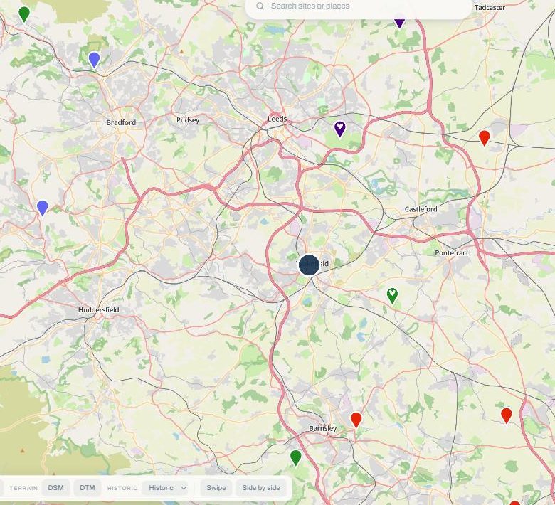
All of them in Visit History, plus your own visits
Maps that show more
Switch the basemap to see what the standard map cannot show.
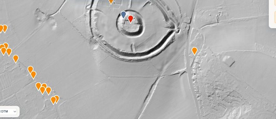 OLD SARUM · LiDAR DTM
LiDAR maps
Two Environment Agency laser scans of England, surface and terrain, strip away the trees and show the shape of the ground. Ramparts, ditches and earthworks are clearly visible where the standard map shows nothing.
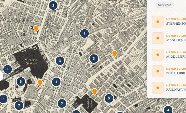 OS SIX-INCH · 1888
Historic maps
Six editions of Ordnance Survey mapping from 1885 to 1955, including the detailed six-inch sheets. See a site as its surveyors recorded it, and use the split view to compare then with now.
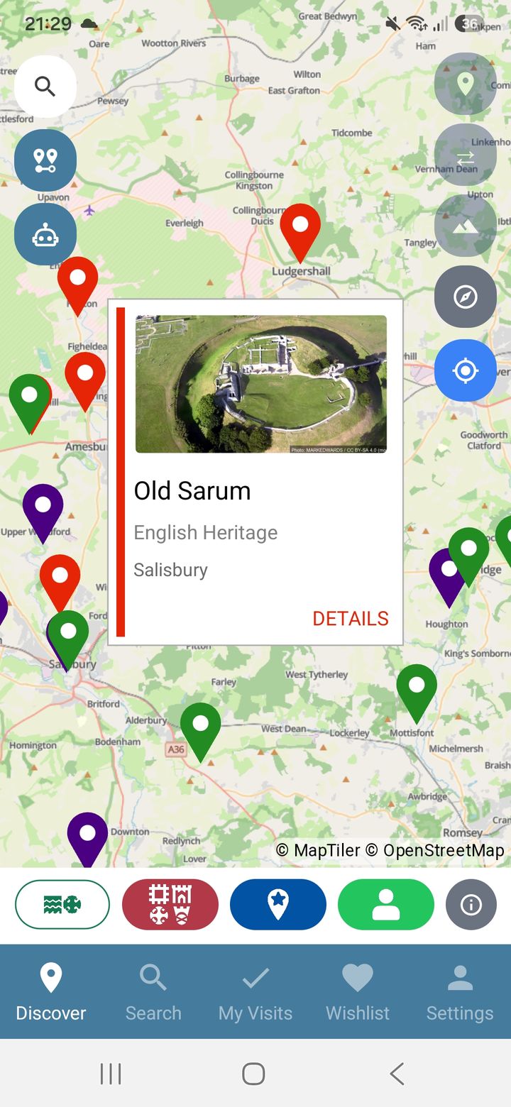
THE APP · iOS & ANDROID
Made for the day out
See what is around you wherever you are stood. Been there? Mark it. Want to go? Wishlist it. Record the date, jot down your thoughts, rate the visit and add photos by snapping them in the app or uploading from your device. Every image is stored securely in the cloud and on your device.
- Discover sites near you, filtered by the organisations you care about
- Visits with dates, notes, star ratings and photographs
- Share comments and photos with the community, or keep them private
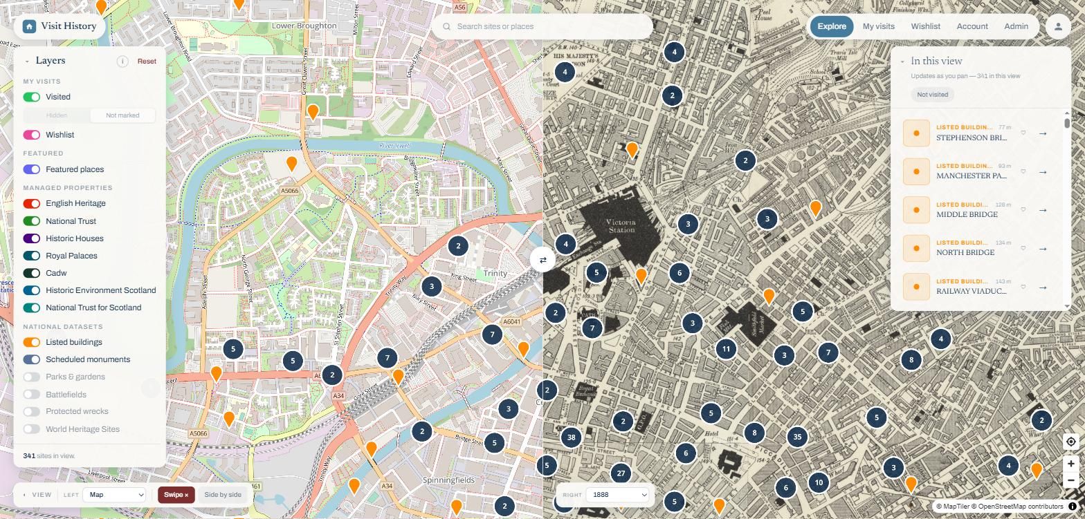
NEW · THE WEB APP
Made for the planning
The same map on a bigger screen, built for planning your next trip. Sixteen layers, satellite and LiDAR basemaps, and a split view to compare any two.
- Search any place, then see every site around it
- LiDAR overlays and side-by-side compare
- Your visited and wishlist pins, straight from the app
One subscription, everywhere
Start with a 7-day free trial. No payment details required. Subscribe on the web, the App Store or Google Play, and it covers the app and the website.
Monthly
£1/month
No payment needed to start the trial. Cancel anytime.
Yearly
£10/year
Save £2 compared to monthly.
New in Visit History
14 October 2026
What Ridge and Furrow Is, and Why So Much of England Is Corduroy
Those long parallel ridges in old pasture are medieval ploughing, built up over centuries by ox teams. Here is how to recognise them, why they curve, and what it means when a field still has them.
10 October 2026
How LiDAR Sees Through Trees, and What It Cannot See
LiDAR does not see underground. It measures the shape of the ground, which is why it can strip a forest off a hillfort and still miss the most famous chalk figure in England.
5 October 2026
Publish Your Visits: Turn a Day Out into a Page on the Website
Members can now publish a visit as a public page on visithistory.online: the site, the date, your comment and the photographs you chose. Here is what goes on the page, what never does, and how to do it.
Want the detail? The full feature list, with screenshots, is one page away.
See everything it doesReady to explore?
Discover history everywhere. Remember every visit.